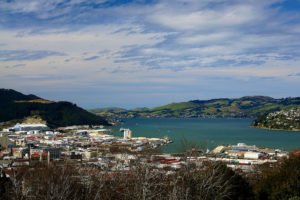
Reclaimed land in South Dunedin might be sinking faster than other areas, GNS Science researchers have found, coinciding with a push by the regional council to decide how to handle natural hazard risk in the region.

Satellite data from ground stations around Dunedin show land might be sinking about 1mm a year – according to a GNS Science report – but reclaimed land around Otago harbour could be subsiding 2-5mm a year.
GNS Science head of regional geology Robert Smillie told Radio NZ that subsidence could mean sea level rise was faster than expected. “You need to know what the sea level is doing relative to the land. So if the land is going down then obviously it will have an impact on the rate of sea level rise.”
The Otago Regional Council (ORC) is also due to consider the natural hazards of South Dunedin, with a technical report being tabled at Wednesday’s council meeting.
In a press release, ORC chief executive Peter Bodeker monitoring had pointed to the increased likelihood of surface flooding associated with rising sea levels.
South Dunedin has 10,000 permanent residents and about 2,700 homes lying less than 50cm above sea level.
Several media outlets covered the GNS Science and ORC reports:
TVNZ: Heavily populated south Dunedin could be sinking according to new research
Radio NZ: Dunedin land could be dipping faster
Otago Daily Times: Effect of sea level rise on Dunedin revealed
Radio NZ: Sinking suburb: Thousands of Dunedin homes at risk
Newshub: Climate change threatens Dunedin ‘red zone’